Guide
Seiseki Sakuragaoka: A Local Guide to Whisper of the Heart
What you can actually see in Seiseki-sakuragaoka, the town that served as a model for Whisper of the Heart: the Youth Post, Irohazaka, Konpira Shrine and the roundabout, plus how long to allow and how to visit respectfully.
By Tama Travel GuideFacts checked: 4 sources
At a glance
- Travel time
- About half an hour from Shinjuku (Keio Line)
- Nearest station
- Seiseki-sakuragaoka, West Exit
- Time needed
- Allow a half day
Contents
Seiseki-sakuragaoka is a quiet suburban town about half an hour from Shinjuku on the Keio Line. Tama City says the backgrounds of Studio Ghibli’s Whisper of the Heart (1995) were drawn with heavy reference to the area around the station. There is no theme park and no Chikyuya antique shop to walk into. What you get is the real slope, stairs, shrine and roundabout that inspired the film, a monument at the station, and a free stamp-rally map. Allow a half day and wear comfortable shoes.
What’s real and what isn’t
| You might expect | What’s actually there |
|---|---|
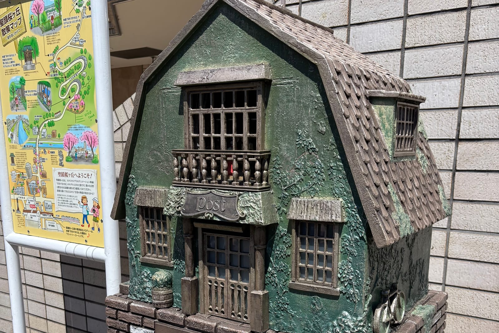
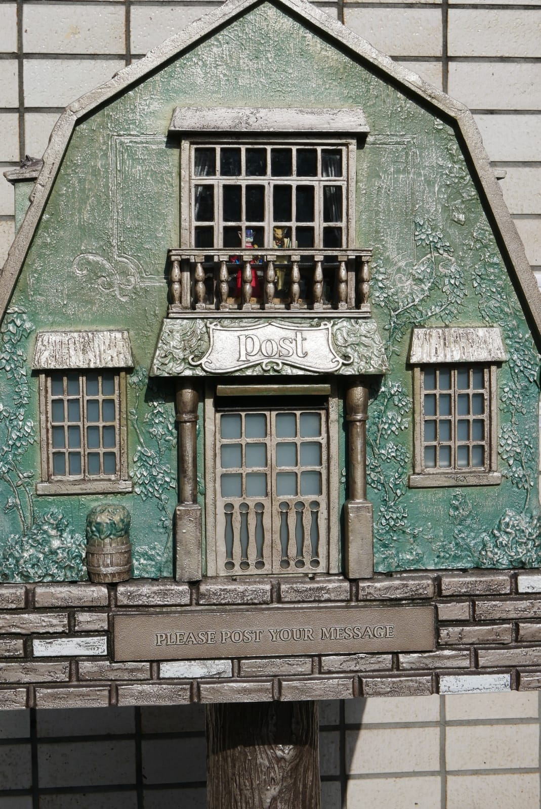
| The Chikyuya antique shop | No such shop. The Youth Post (青春のポスト) at the station’s West Exit is a monument modelled on Chikyuya. Tama City’s map notes that it is not a real postbox |
| The Baron statue | Reports say a small Baron figure is visible inside the Youth Post |
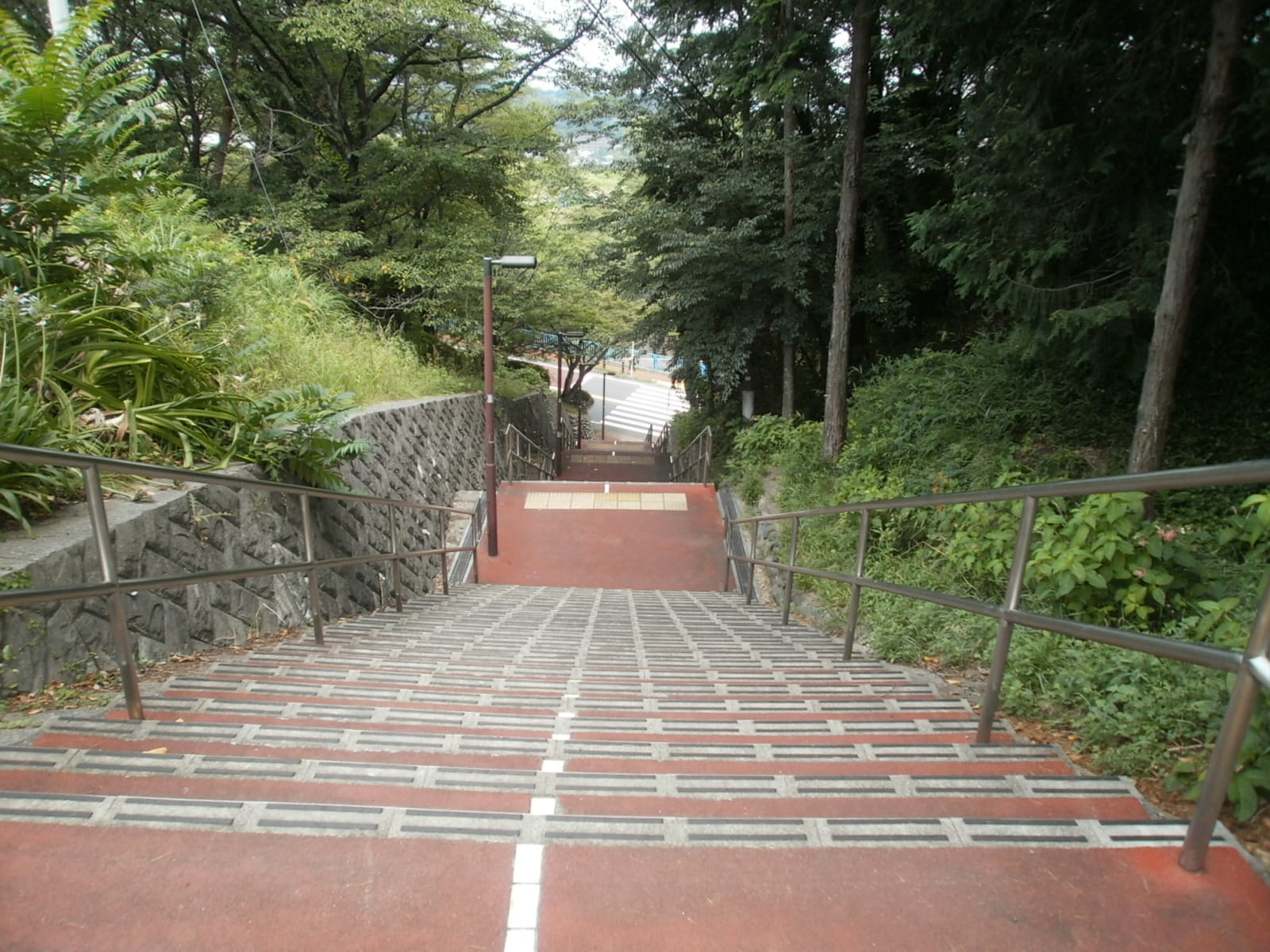
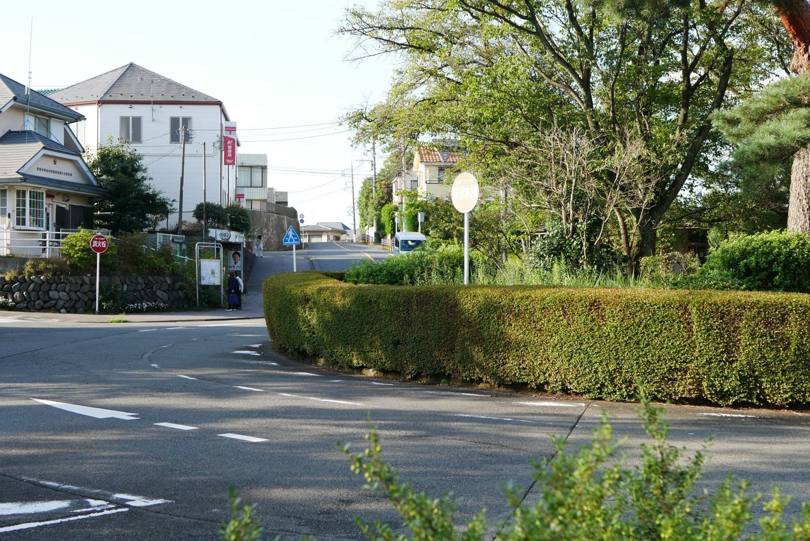
| The steep slope Shizuku climbs | Irohazaka (いろは坂), a winding road with a stairway. The map calls the stairs the model for those in the film |
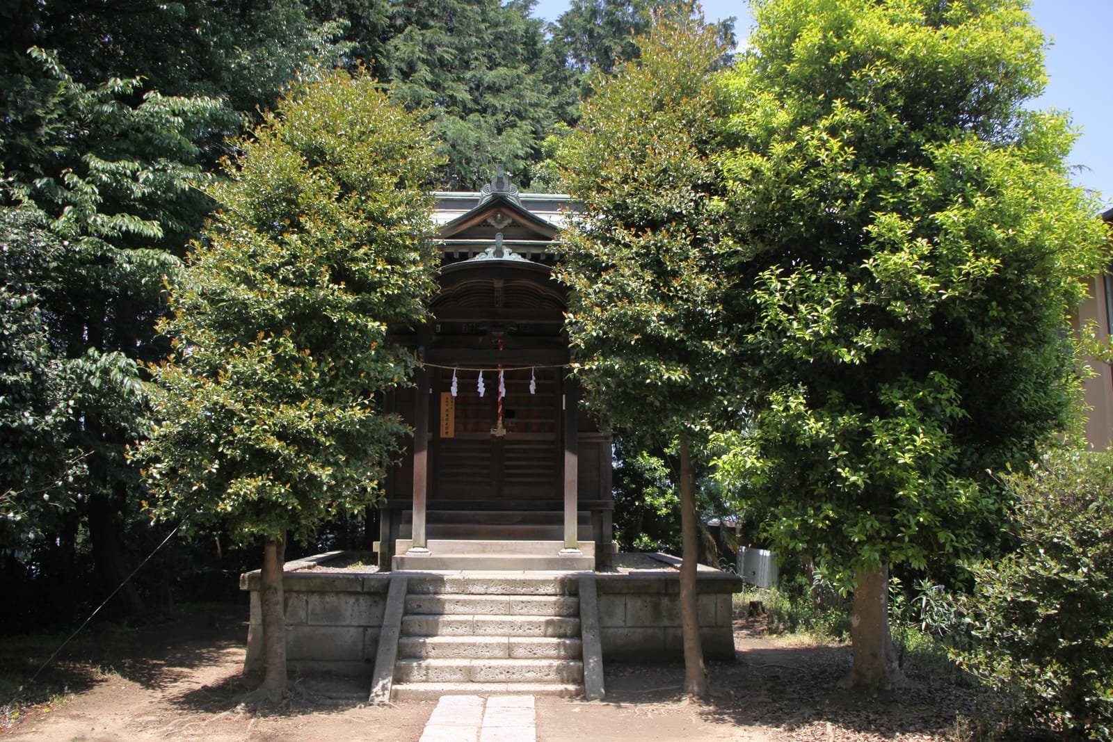
| The shrine where Sugimura confesses | Konpira Shrine (金比羅神社) on Irohazaka, a small shrine in a residential area |
| The roundabout near Chikyuya | The Sakuragaoka roundabout (ロータリー), which the map describes as said to be the model |
| The library | The map says that Irohazaka Sakura Park (いろは坂桜公園) is where the library stood in the film |
| “Country Road” | It plays as the train approach melody at Seiseki-sakuragaoka Station, and the inbound and outbound platforms play different versions |
.jpg)
The main stops in order
Tama City’s walking map (April 2025 edition) runs from the station up the hill to the roundabout:
- Seiseki-sakuragaoka Station (聖蹟桜ヶ丘), West Exit. See the Youth Post and the map board. Visitors can write a dream or goal on a card and post it in the Youth Post.
- Sakura-dori and the Kasumigaseki Bridge (霞ヶ関橋). Cross the Otakuri River (大栗川). The map shows a riverside promenade where you can stroll or rest on the bank.
- Irohazaka Sakura Park. A small park with a view back over the station area. The map says the cherry blossoms are lovely in spring.
- Irohazaka and the stairs. The steepest part of the walk. Full details are in Climbing Irohazaka.
- Konpira Shrine. The map says this is where Kamakura-period fighting between Nitta Yoshisada and the Hojo army took place. Please be quiet here.
- Tenshudai (天守台). The highest point of the route. It was a lookout from the Kamakura period and is said to be the site of Sekido Castle.
- The Sakuragaoka roundabout. Two stamp-rally spots are here: Noa Yogashiten, a Western-style sweets shop, and Dining Wazakura. Haramine Park (原峰公園) is about 3 minutes’ walk away, according to the map.
For turn-by-turn directions and a map, see Whisper of the Heart Walking Route and Map.
The stamp rally
The paper walking map has stamp spaces, and the stamps are kept at four places (per the April 2025 map):
- In front of the 2F elevator by the Keio Store, Building A, Seiseki SC (by the station)
- FamilyMart on Sakura-dori
- Noa Yogashiten (at the roundabout)
- Dining Wazakura (at the roundabout)
Stamps 3 and 4 share the same space on the map, so either shop will do. Shop opening hours apply, so the roundabout stamps may not be available every day.
How long to allow
| Plan | Time |
|---|---|
| Station and Youth Post only | Under an hour, including a café stop |
| Station → Irohazaka → roundabout, then bus back | Half a day |
| Add Haramine Park, or Sakuragaoka Park and the Former Tama Seiseki Memorial Hall | Most of a day |
GO TOKYO describes Sakuragaoka Park, reached by bus to Kinenkan-mae, as a wooded park famous for cherry blossoms. The Former Tama Seiseki Memorial Hall inside it is free to enter and has a café. Opening days are limited, so check before you go.
When to go
- Daylight, any season. This is a residential area, and the views are the point of the walk.
- Spring: the map highlights cherry blossoms at Irohazaka Sakura Park and along Sakura-dori. Seasonal details are in Cherry Blossoms in Tama.
- February to early March: the map says Haramine Park has about 120 plum trees, the largest plum grove in Tama City.
- Rain: the stairs on Irohazaka can be awkward when wet.
Visiting respectfully
.jpg)
Tama City’s map makes three requests, and we’d add the same:
- People live here. Don’t litter and don’t make noise.
- The pavements are narrow in places. Walk in single file and watch for cars.
- Konpira Shrine is a small local shrine. Keep your voice down, and don’t block the path for photos.
Food and breaks
The station connects directly to the Keio Seiseki-sakuragaoka Shopping Center, which has cafés and bakeries. Up at the roundabout, the two stamp shops are the obvious stop. Our picks are in Lunch in Seiseki: Cafes and Bakeries. According to the map, there are toilets at Yu Sakuragaoka (ゆう桜ヶ丘) next to Haramine Park.
Getting there
Take the Keio Line from Shinjuku (新宿), with no transfers, and avoid trains bound for Hashimoto (橋本). The full guide is in How to Get to Seiseki Sakuragaoka From Shinjuku. If you’re also thinking about the Ghibli Museum, see Ghibli Museum vs the Whisper of the Heart Walk.
Places and routes are based on Tama City’s walking map (April 2025) and official pages, checked in October 2026.
Prices and hours change. Check the official site before you go.