Walking route
Mt. Takao Trails Compared: Trail 1, Trail 6 and the Inariyama Course
Distance, time, difficulty and toilets for Mt. Takao's three main trails from the official trail map, what each one is like underfoot, and which to walk up or down.
By Tama Travel GuideFacts checked: 5 sources
At a glance
- Walking
- Trail 1 3.8 km / Trail 6 3.3 km / Inariyama 3.1 km
- Time needed
- About 100 min up on each (official map)
- Nearest station
- All three start near Takaosanguchi
- Best for
- Trail 1 first-timers; 6 and Inariyama hikers
Contents
Mt. Takao (599 m) has three main ways up from the bottom. Trail 1 is paved and passes Yakuoin Temple. It has the most toilets and shops and suits first-timers. Trail 6 climbs beside a stream through forest and ends with stepping stones and a long staircase. The Inariyama course follows a sunny ridge with a viewpoint, but has no toilets and rates hardest of the three. On Takao Tozan Railway’s official map, each one takes about 100 minutes up and 80 minutes down. A common plan is to walk up Trail 6 or Inariyama and come down Trail 1 or by cable car.
All figures below come from the official trail map and course list as of October 2026, unless noted.
The three main trails side by side

| Trail 1 (Omotesando) | Trail 6 (Biwa Waterfall) | Inariyama course (Ridgeline) | |
|---|---|---|---|
| Japanese name | 1号路(表参道コース) | 6号路(びわ滝コース) | 稲荷山コース(見晴らし尾根コース) |
| Length | 3.8 km | 3.3 km | 3.1 km |
| Up / down | 100 min / 80 min | 100 min / 80 min | 100 min / 80 min |
| Official difficulty | ★★ | ★★★ | ★★★★ |
| Toilets on the way | 5 | 2 (Kiyotaki Station, summit) | None |
| Surface | Paved road, steep in places, stairs near the top | Dirt path, roots and rocks, stepping stones in the stream, long wooden stairs | Wooden stairs at the start, then a rooty ridge path, 200+ steps before the summit |
| Highlights | Octopus Cedar, Yakuoin Temple, Monkey Park, viewpoints | Biwa Waterfall, forest and stream, cool in summer | Inariyama viewpoint (396 m) with a shelter, autumn leaves |
| Shops and food | Many | Almost none until the top | None until the top |
TAKAO 599 MUSEUM, the Hachioji City museum at the foot of the mountain, gives slightly different times in its own guide (for example 90 minutes up for Trail 6 and the Inariyama course, and 110 minutes up Trail 1 without the cable car). Treat all of them as rough times at an easy pace, not including breaks.
The cable car and chairlift both reach the middle of Trail 1. From the top station, Takao Tozan Railway puts the walk to the summit at about 40 minutes. See the cable car and chairlift guide.
Trail 1: the main road up
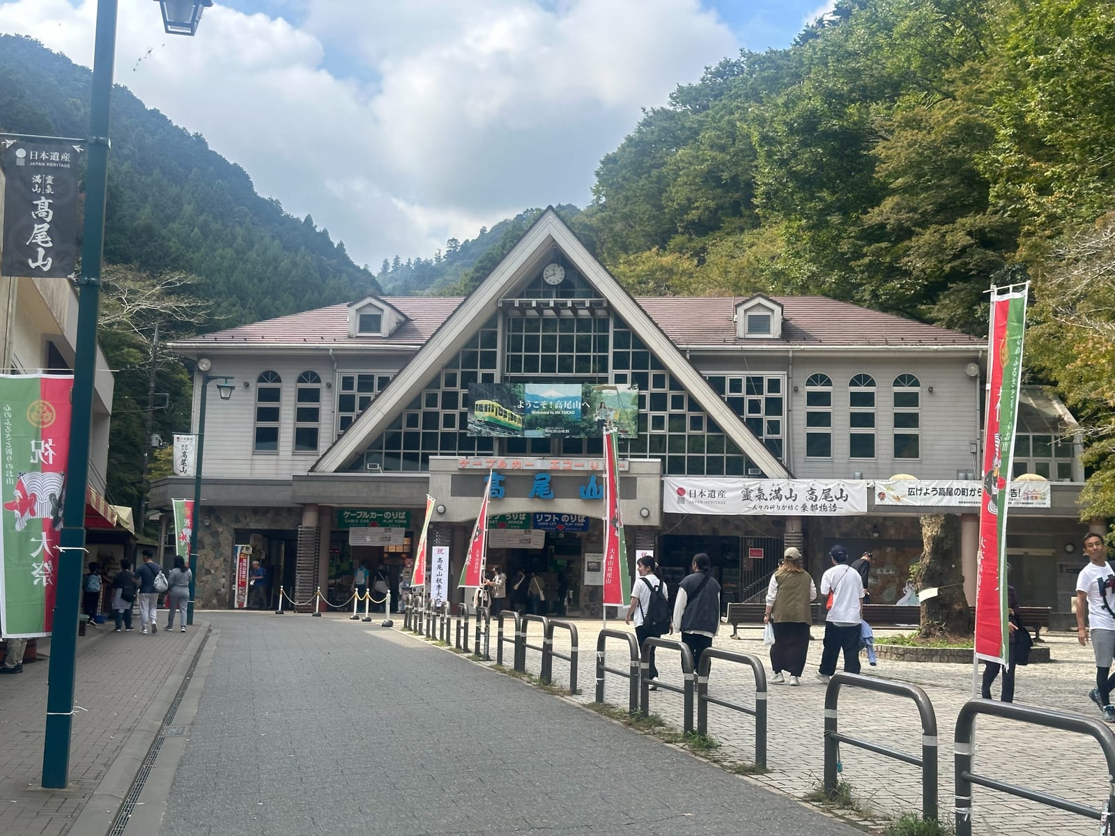
Trail 1 starts to the right of the square in front of Kiyotaki Station. Cars and bicycles are not allowed, but the trail is paved all the way to the temple.
- The bottom half is the hard part. The Hachioji accessibility map describes the section from the foot to the cable car top as very steep, about 2 km and 60 minutes. Many people ride this part and walk the rest.
- Kasumidai is the viewpoint next to the cable car’s Takaosan Station, where walkers and cable car riders meet.
- Monkey Park, the Octopus Cedar and Joshinmon Gate come next. After the gate, the path splits into Otoko-zaka, a stairway of 108 steps, and Onna-zaka, a gentle slope. They meet again before the temple, and each is about 1 km and 20 minutes from the cable car top to the temple.
- Yakuoin Temple is about 20 minutes from the cable car. See our Yakuoin guide.
- Temple to summit is about 800 m and 20 minutes, with stairs and steep sections. The accessibility map also shows a gravel road (about 1 km, 25 minutes) used by emergency vehicles.
Best for: first visits, mixed groups, rainy days, and coming down. It is also the busiest trail.
Trail 6: forest and water
Trail 6 starts along the paved road to the left of Kiyotaki Station. You walk past houses, so watch for cars. The trail proper begins near a small bridge before the Tokyo Takao Hospital building.
- Biwa Waterfall is a waterfall training site of Yakuoin. Takao Tozan’s map notes you may see people training under it even in midwinter. Take the left fork to see it, then come back to the fork to continue on Trail 6.
- After the waterfall the path gets narrow. The museum guide says that in busy periods this part is one-way, uphill only. Mossy rocks are slippery.
- Near the top, the trail runs up the streambed on stepping stones, then climbs a long wooden staircase. If you’d rather avoid these, a side path just before the stepping stones joins the Inariyama course.
- Takao Tozan’s FAQ recommends hiking boots rather than street shoes, and this is the trail where it matters most.
Best for: hot days, nature lovers and people who enjoy a proper mountain path. Because of the one-way rule and the slippery rocks, it is better walked up than down.
Inariyama course: the ridge
The Inariyama course starts at a small bridge to the left of Kiyotaki Station and goes straight up narrow, steep wooden stairs. The museum guide notes there can be queues here in peak season because it is hard to pass.
- Asahi Inari Shrine is partway up the stairs. After it the slope eases.
- On the ridge the path is mostly level but full of roots and rocks.
- Inariyama (396 m) has a viewing platform and a shelter. The ridge is sunny, with wide views and, in autumn, maple colours.
- Where it meets Trail 5, more than 200 steps lead to the summit. Tired walkers can take Trail 5 to the right instead and join Trail 1 below the summit.
Best for: views and autumn leaves. There are no toilets on the way, so go at Kiyotaki Station before you start. There are no shops either, so carry water and a snack. Takao Tozan’s guide says some trails have no shops until the ridge.
Shorter loops near the top
| Trail | Length | Time | What |
|---|---|---|---|
| Trail 2 (Kasumidai loop) | 0.9 km | 40 min loop | Circles the Monkey Park area |
| Trail 3 (Katsura forest) | 2.4 km | 60 up / 50 down | Quiet forest on the south side |
| Trail 4 (Suspension bridge) | 1.5 km | 50 up / 40 down | Miyama Bridge, the only suspension bridge on Takao |
| Trail 5 (Summit loop) | 0.9 km | 30 min loop | Flat loop around the summit |
Trail 4 is a good way to avoid the crowds on Trail 1 between the temple area and the summit. None of these four has toilets.
Which combination to choose
| You are… | Up | Down |
|---|---|---|
| New to hiking, or with kids | Cable car or lift | Trail 1 to the cable car, or ride down |
| Fit, want nature | Trail 6 | Trail 1 (or cable car from the middle) |
| Fit, want views | Inariyama course | Trail 1 or Trail 6 (not in busy periods) |
| Short on time | Cable car + Trail 1 | Same way |
Takao Tozan Railway asks hikers to plan to be off the mountain before sunset. The forest gets completely dark, so carry a light if you might be late. Fires are banned on the whole mountain, and you are asked to take all rubbish home.
Before you go
- Shoes with grip. Street shoes are fine on Trail 1, but not on Trail 6 or Inariyama.
- Water and a snack, especially for Inariyama.
- Toilet at Kiyotaki Station before you start.
- A rain layer. The operator says mountain weather changes quickly.
- Getting there: see the Mt. Takao day trip from Shinjuku.
Prices and hours change. Check the official site before you go.
Plan this trip
Sources(checked on October 4, 2026)
- Takao Tozan Railway: Mt. Takao Nature and Hiking Trail Map (English, PDF)
- Takao Tozan Railway: Hiking courses, length and toilets (Japanese)
- Takao Tozan Railway: Hiking guide and FAQ (Japanese)
- TAKAO 599 MUSEUM: How to walk Mt. Takao, course by course (Japanese)
- Hachioji Visitors & Convention Association: Mt. Takao Accessibility Map, Trail 1 (PDF)